Rapid access to shared data and information is the key to successful planning and response to disasters. Many of the complex geoinformation (GIS) systems used today exist as standalone islands that were not designed to be interoperable. Thus, many of today's advanced systems do not currently work together from an overall mission or joint perspective. Additionally, despite all the advances in satellite and environmental data acquisition, processing and distribution, the “last mile”, getting the data to the end user, is still the hardest part.
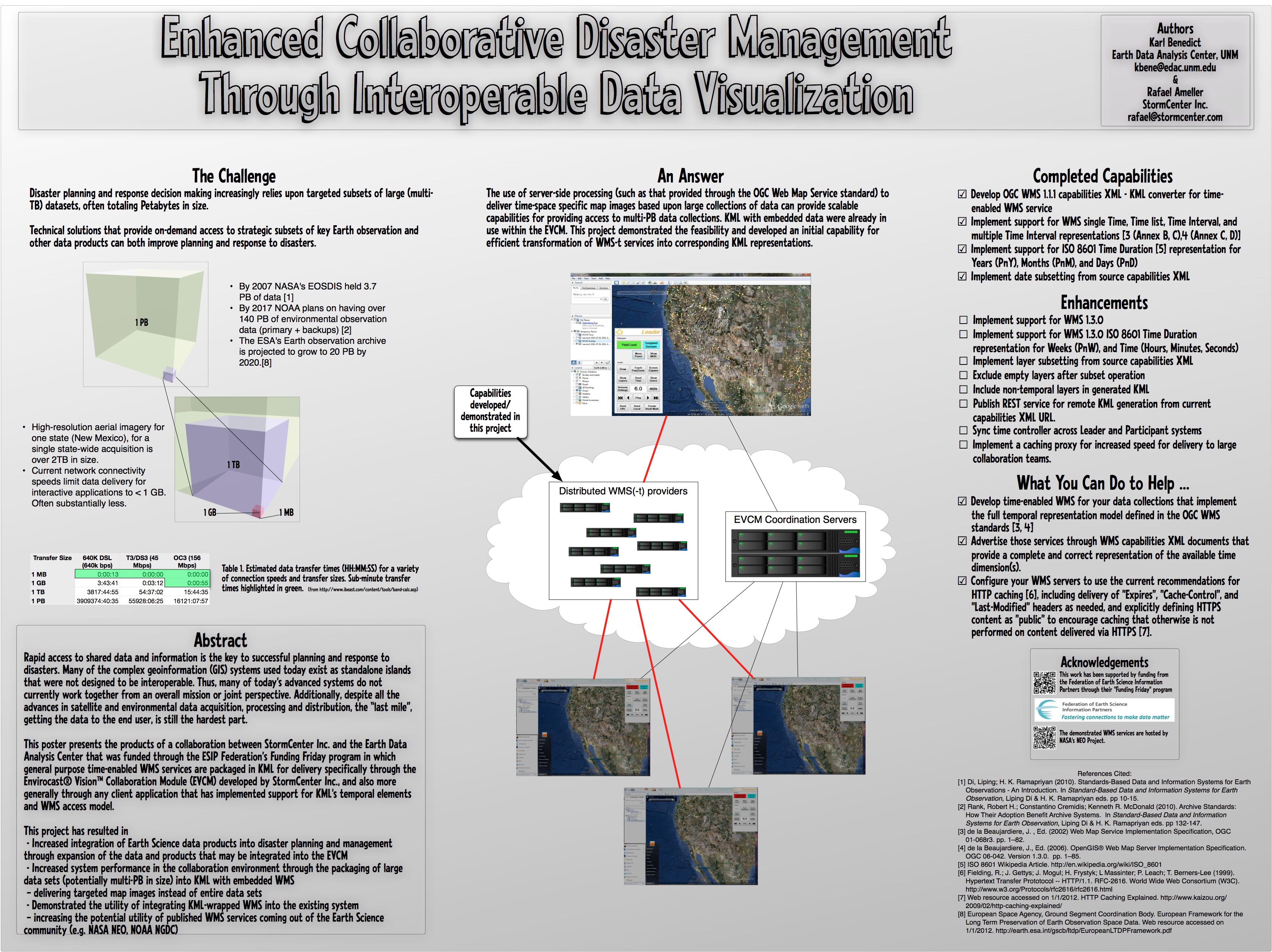
This poster presents the products of a collaboration between StormCenter Inc. and the Earth Data Analysis Center that was funded through the ESIP Federation's Funding Friday program in which general purpose time-enabled WMS services are packaged in KML for delivery specifically through the Envirocast® Vision™ Collaboration Module (EVCM) developed by StormCenter Inc., and also more generally through any client application that has implemented support for KML's temporal elements and WMS access model.
This project has resulted in:
- Increased integration of Earth Science data products into disaster planning and management through expansion of the data and products that may be integrated into the EVCM
- Increased system performance in the collaboration environment through the packaging of large data sets (potentially multi-TB in size) into KML with embedded WMS – delivering targeted map images instead of entire data sets
- Demonstrated the utility of integrating KML-wrapped WMS into the existing system – increasing the utility of published WMS services coming out of the Earth Science community (e.g. NASA NEO, NOAA NGDC)
Submitted by: Karl Benedict, Earth Data Analysis Center, UNM, [email protected]
 | Name: Karl Benedict Organization(s): University Libraries ,University of New Mexico |
 | Name: Rafael Ameller Organization(s): StormCenter Inc |