The Open Geospatial Consortium (OGC), via their standards process, has developed protocol standards implemented operationally at various level such as WMS, WFS, WCS, and CSW.
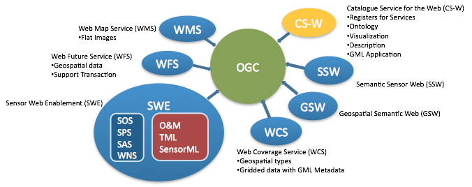
Some OGC Services:
- Web Map Service (WMS)
- Web Feature Service (WFS)
- Web Coverage Service (WCS)
- Sensor Web Enablement (SWE)
- Catalog Services - Web (CS-W)
- Geospatial Semantic Web (GSW)
- Semantic Sensor Web (SSW)
Images: