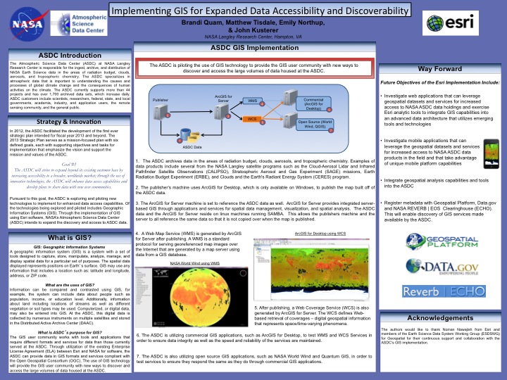
NASA’s Atmospheric Science Data Center (ASDC) is piloting the use of Geographic Information System (GIS) technologies that can increase data discoverability and accessibility of ASDC data to the GIS user community in formats that are more conducive to their needs than formats currently served at the ASDC. By utilizing the existing Enterprise License Agreement (ELA) between Esri and NASA for software the ASDC will be able to provide data in GIS formats and Open Geospatial Consortium (OGC) compliant services. These services will include a Web Mapping Service (WMS), Web Coverage Service (WCS), and Web Processing Service (WPS). This is expected to yield a greater usage of NASA ASDC data as well as promote new analyses utilizing GIS tools for an increased understanding in the earth’s radiation budget, clouds, aerosols, and tropospheric chemistry.
 | Name: Brandi Quam Organization(s): Booz Allen Hamilton Email: brandi.m.quam@nasa.gov |
| Name: Matthew Tisdale Organization(s): Booz Allen Hamilton Email: matthew.s.tisdale@nasa.gov |
| Name: Emily Northup Organization(s): NASA OSSI Email: emily.a.northup@nasa.gov |
| Name: John Kusterer Organization(s): Atmospheric Science Data Center ,NASA Langley Research Center Email: john.m.kusterer@nasa.gov |