The paradigm for discovering and accessing this data has long been driven through drill-downs, metadata result tables, with small thumbnail images as an after thought. However, our personal consumption is facilitated by window-shopping and product previews, not just product specification sheets. When was the last time you bought something you hadn’t seen/touched/heard first?
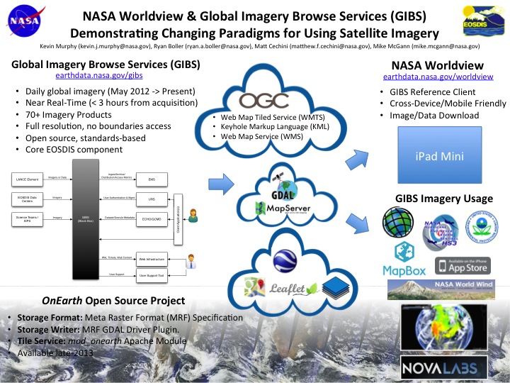
The NASA Earth Observing System Data and Information System (EOSDIS) is now providing full resolution satellite imagery, for specific products, within three hours of observation. The NASA Global Imagery Browse Services (GIBS) provides this high quality imagery through publicly accessible, standards-based, tiled web mapping services. This has been accomplished by leveraging a combination of existing open source geospatial packages and standards and newly open-sourced NASA-developed software. Unlike ever before, researchers and rapid responders can visually interact with data of interest before ever having to process it on their own. EOSDIS is changing how Earth Science data is discovered for all of its users.
The NASA Worldview (http://earthdata.nasa.gov/
 | Name: Matthew Cechini Organization(s): NASA Email: [email protected] |