National Institute of Food and Agriculture/USDA Multi-Model Simulations and Satellite Observations for Assessing Impacts of Climate Variability on the Agro-ecosystems in California and Southwestern United States
M. Kafatos, H. M. El-Askary, N. Hatzopoulos, J. Kim, D. Medvigy C. Tremback and R. Walko., D. Stack, B. Myoung, S. H. Kim.
Introduction Apsim Regions is a one-way nested climate-crop modeling framework that links gridded weather data (rain, temperature, radiation, etc.) with the point-specific Agricultural Production Systems sIMulator (APSIM) crop model. ApsimRegions was a tool developed with the goal of better understanding the impacts of climate, soils, and management decisions on crop yields in the Southwestern US. Crop models simulate the growth and development of crops in response to environmental drivers (Fig. 1). Traditionally, process-based crop models have been run at the local farm level for management scenario optimization. Few previous studies have used these models over large geographic regions. In particular, assessment of regional-scale yield variability due to climate change requires the merging of high-resolution, regional-scale, datasets, many of which have been unavailable until recently.
NASA Science Mission Directorate’s Earth Science Division Feasibility Assessment of Using Satellite Data for Enhancing Wildland Fire Decision Support and Warning Systems
S. Nghiem, M. Kafatos, F. Fujioka, X. Liu, N. Hatzopoulos, D. Stack, B. Myoung, S. H. Kim., C. Tremback, L. Rodriguez, H.M. El-Askary.
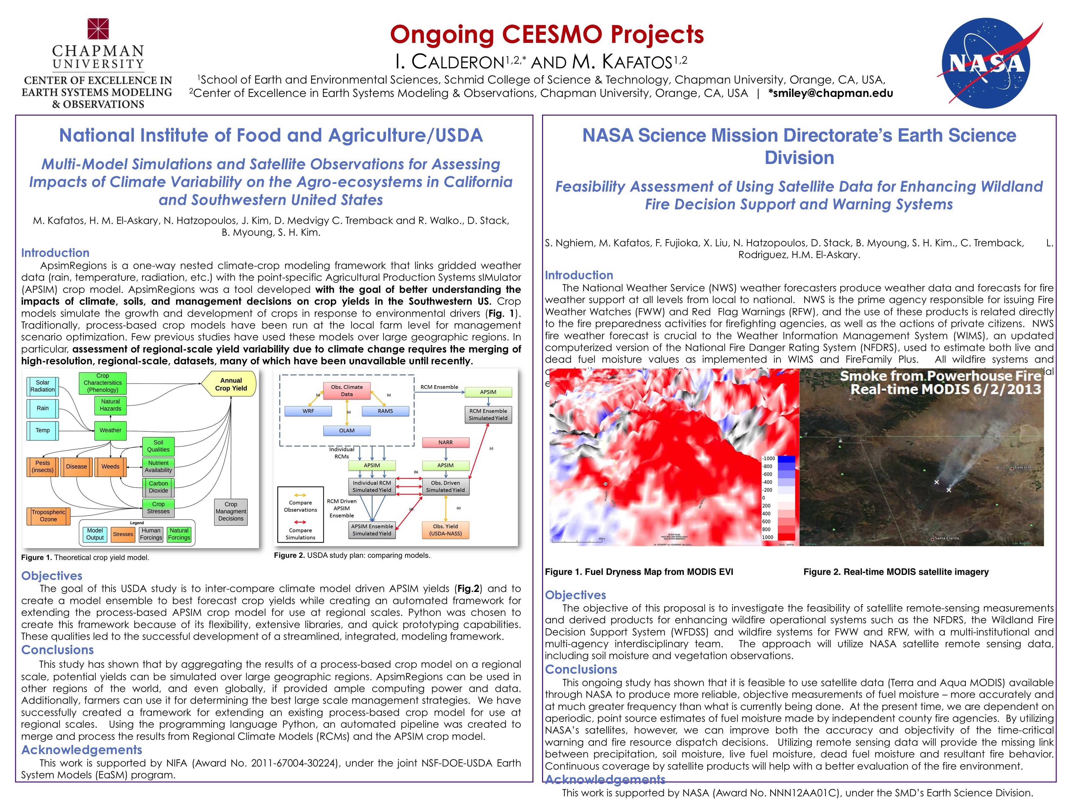
Introduction The National Weather Service (NWS) weather forecasters produce weather data and forecasts for fire weather support at all levels from local to national. NWS is the prime agency responsible for issuing Fire Weather Watches (FWW) and Red Flag Warnings (RFW), and the use of these products is related directly to the fire preparedness activities for firefighting agencies, as well as the actions of private citizens. NWS fire weather forecast is crucial to the Weather Information Management System (WIMS), an updated computerized version of the National Fire Danger Rating System (NFDRS), used to estimate both live and dead fuel moisture values as implemented in WIMS and FireFamily Plus. All wildfire systems and organizations can benefit from using NASA remote sensing data for an assessment of po
 | Name: M. Kaftos Organization(s): Chapman University |
| Name: I. Calderon Organization(s): Chapman University |