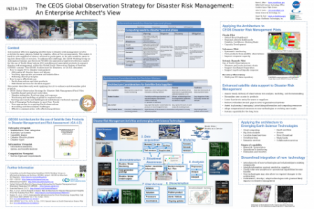
The Committee on Earth Observation Satellites (CEOS) Working Group on Information Systems and Services (WGISS), on behalf of the Global Earth Observation System of Systems (GEOSS), is defining an enterprise architecture (known as GA.4.D) for the use of satellite observations in international disaster management. This architecture defines the scope and structure of the disaster management enterprise (based on disaster types and phases); its processes (expressed via use cases / system functions); and its core values (in particular, free and open data sharing via standard interfaces). The architecture also details how a disaster management enterprise describes, obtains, and handles earth observations and data products for decision-support; and how it draws on distributed computational services for streamlined operational capability.
We have begun to apply this architecture to a new CEOS initiative, the Global Observation Strategy for Disaster Risk Management (DRM). CEOS is defining this Strategy based on the outcomes of three pilot projects focused on seismic hazards, volcanoes, and floods. These pilots offer a unique opportunity to characterize and assess the impacts (benefits / costs) of the GA.4.D architecture in practice. In particular, the DRM Floods Pilot is applying satellite-based optical and radar data to flood mitigation, warning, and response, DRM Floods Pilot is applying satellite-based optical and radar data to flood mitigation, warning, and response, including monitoring and modeling at regional to global scales. It is focused on serving user needs and building local institutional / technical capacity in the Caribbean, Southern Africa, and Southeast Asia. In the context of these CEOS DRM Pilots, we are characterizing where and how the GA.4D architecture helps participants to:
- Understand the scope and nature of hazard events quickly and accurately
- Assure timely delivery of observations into analysis, modeling, and decision-making
- Streamline user access to products
- Lower barriers to entry for users or suppliers
- Streamline or focus field operations in disaster reduction
- Reduce redundancies and gaps in inter-organizational systems
- Assist in planning / managing / prioritizing information and computing resources
- Adapt computational resources to new technologies or evolving user needs
- Sustain capability for the long term
Insights from this exercise are helping us to abstract best practices applicable to other contexts, disaster types, and disaster phases, whereby local communities can improve their use of satellite data for greater preparedness. This effort is also helping to assess the likely impacts and roles of emerging technologies (such as cloud computing, "Big Data" analysis, location-based services, crowdsourcing, semantic services, small satellites, drones, direct broadcast, or model webs) in future disaster management activities.


