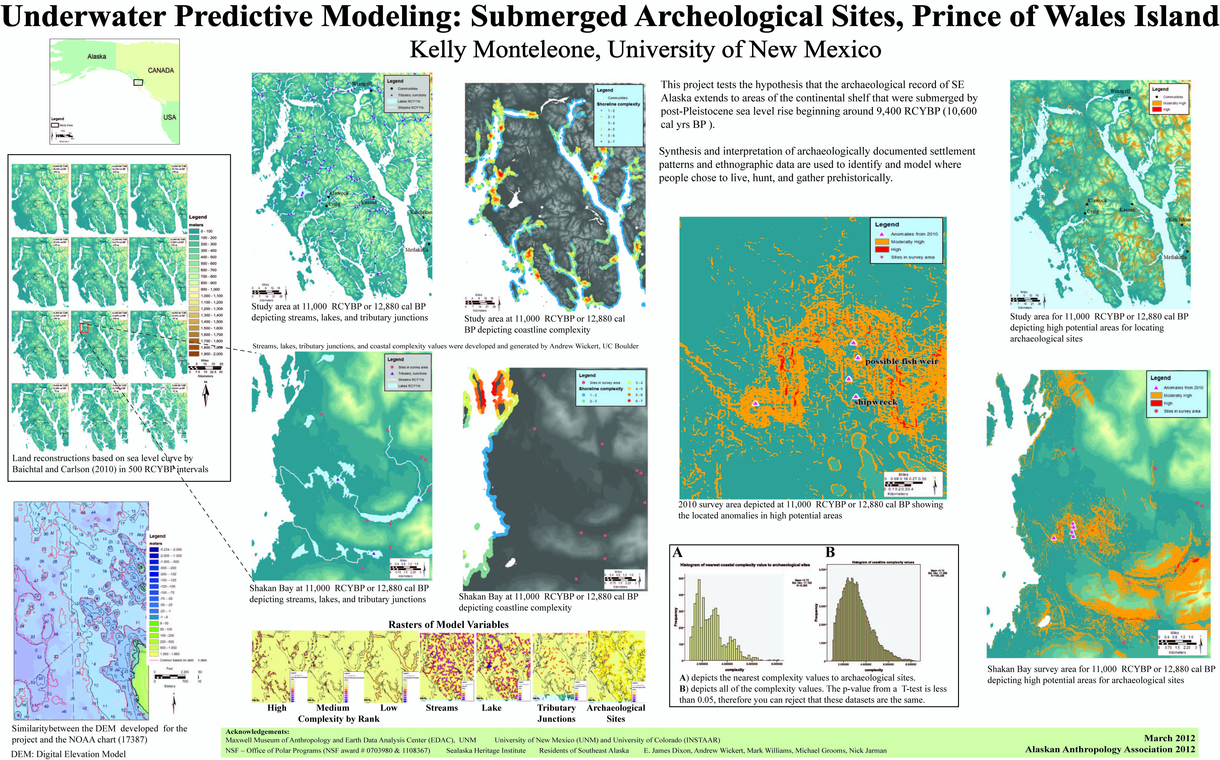
Synthesis and interpretation of archaeologically documented settlement patterns and ethnographic data are used to identify and model where people chose to live, hunt, and gather prehistorically. This project tests the hypothesis that the archaeological record of SE Alaska extends to areas of the continental shelf that were submerged by post-Pleistocene sea level rise beginning around 10,600 cal yrs BP (9,400 RCYBP). A digital elevation model (DEM) and sea-level curve for southeastern Alaska are used to create time slices between 18,100 to 10,600 cal yrs BP. The variables (slope, aspect, distance from paleo-stream, paleo-lakes, paleo-coastlines, and known archaeological sites, and type of coastline) included in the predictive model are incorporated and presented in the final model identifying the high potential areas. This model will be used to identify high potential survey areas for underwater archaeological surveys during the next three years (NSF Polar Programs -#1108367).
Poster Presented at the Alaska Anthropology Association Annual Meeting March 2012
 | Name: Kelly Monteleone Organization(s): University of New Mexico Email: krbm@unm.edu |