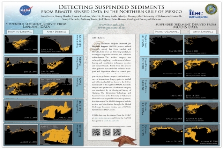
The Sediment Analysis Network for Decision Support (SANDS) project utilized remotely sensed data from Landsat and MODIS, both prior and following landfall, to investigate suspended sediment and sediment redistribution. The satellite imagery was enhanced by applying a combination of cluster busting and classification techniques to color and infrared bands. Results from the process show patterns associated with sediment transport and deposition related to coastal processes, storm-related sediment transport, post-storm pollutant transport, and sediment-current interactions. Imagery prior to landfall and following landfall are shown to the left for Landsat and to the right for MODIS. Scientific analysis and production of enhanced imagery was conducted by the Geological Survey of Alabama. The Information Technology and Systems Center at the University of Alabama in Huntsville was responsible for data acquisition, development of the SANDS data portal and the archive and distribution through the Global Hydrology Resource Center, one of NASA’s Earth Science Data Centers.
SANDs data may be obtained from the GHRC at ghrc.nsstc.nasa.gov and from the SANDS data portal atsands.itsc.uah.edu.
This project was funded by the NASA Applied Sciences Division


