
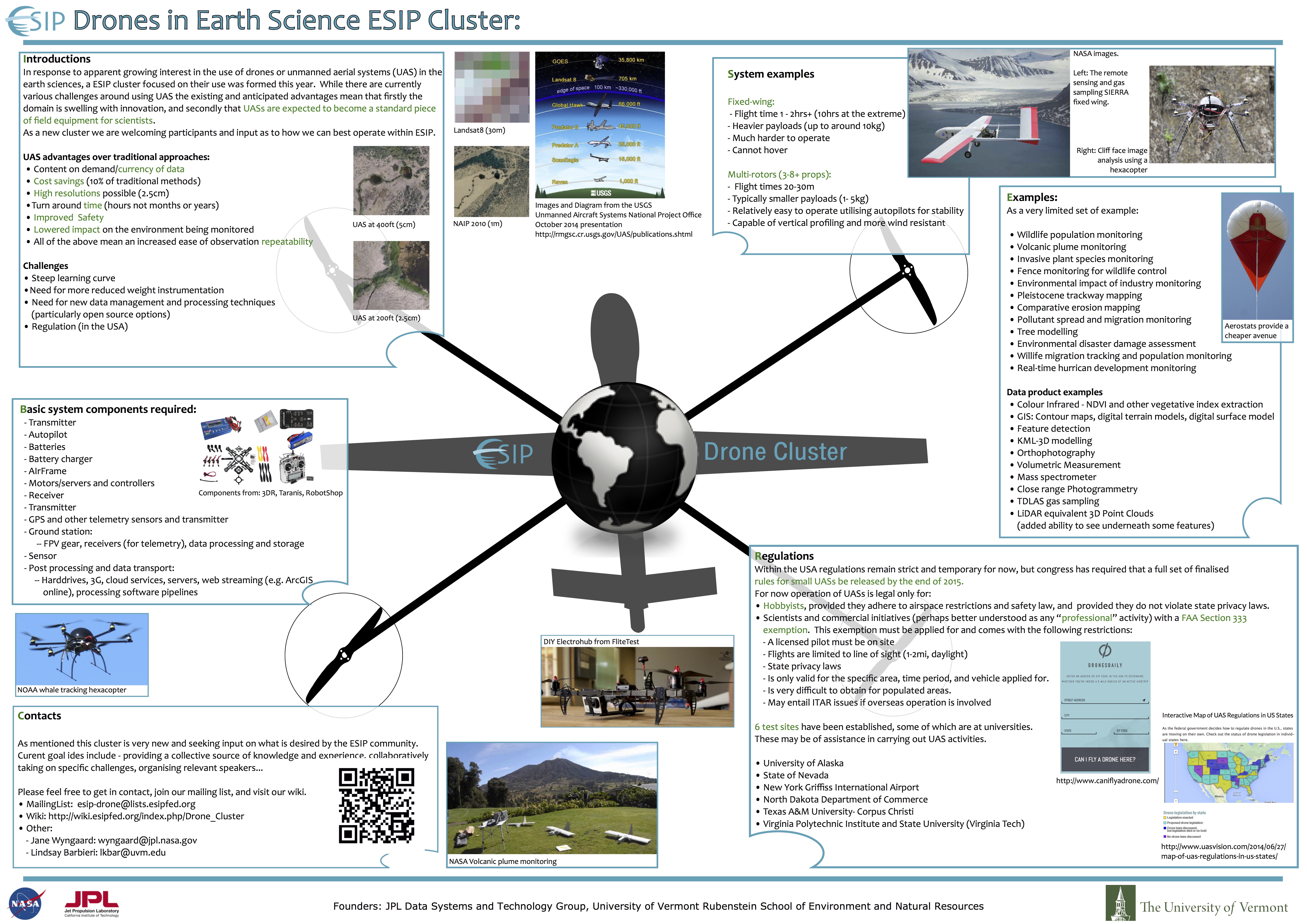
In response to apparent growing interest in the use of drones (or unmanned aerial vehicles) in the earth sciences, a ESIP cluster focused on their use was formed this year.
As with any other tool the applicability of a drone to a problem exists on a situationally dependant spectrum, yet it is exciting to see the many experiments and analysis, that were previously impossible due to practical, physical, or financial reasons, now being enabled or enhanced. Drone enabled research results are being published in a wide a range of domains, even as the development of drone technologies themselves are equally innovative. As a very limited set of examples, current earth science research being carried out with drones includes rapid and regularly repeatable monitoring of: volcanic plumes, agriculture gas emissions, large and small scale vegetation changes, glacier status, wildlife migrations and population changes, real-time hurricane development, and pollutant spread and migration.
Given its nascent state, the use of drones in the earth sciences currently requires researches to innovate not only with regards to the science but also in the adaption of traditional sensors, or creation of new observational techniques. Further, with such changes comes the need for similar adaption as regards the required software for data management, analysis, and presentation. Consequently there is wide scope and need for collaboration and sharing of experiences and tools. As a new cluster we are still exploring our goals and would welcome input on such.
Particularly we are exploring the communities foremost needs as regards drone research within ESIP, and how this cluster might best meet these needs. It may be that providing informal training, via industry and collaborator presentations, is most valuable. Or alternatively, it might be that providing an environment and team within which the cluster cooperatively tackles some of the earth science specific challenges of drone use (such as data formats, sensor development, or drone selection and design) is most desirable. Most likely it will be a mixture of the above, again we invite interested parties to comment and give input.
 | Name: Jane Wyngaard Organization(s): JPL Data Systems and Technology Group Email: wyngaard@jpl.nasa.gov |
| Name: Lindsay Barbieri Organization(s): University of Vermont Email: lkbar@uvm.edu |